Search
Search Results
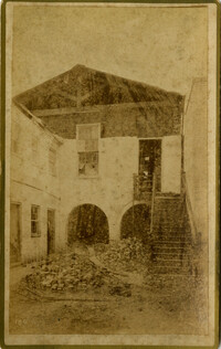
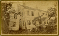
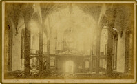
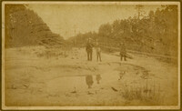
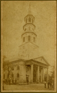
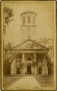
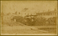
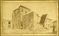
- Creator:
- Cook, Geo. L. (George L.)
- Collection:
- Charleston Museum Earthquake Photographs
- Institution:
- The Charleston Museum Archives
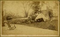
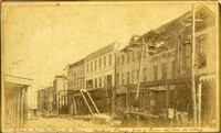
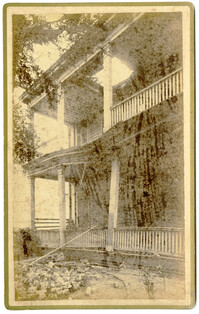
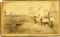
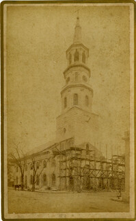
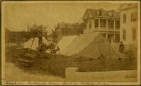
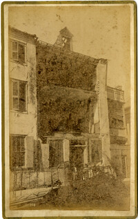
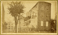
- Creator:
- Cook, Geo. L. (George L.)
- Collection:
- Charleston Museum Earthquake Photographs
- Institution:
- The Charleston Museum Archives
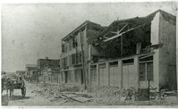
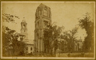
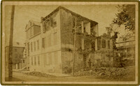
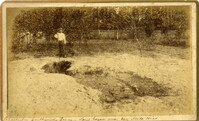
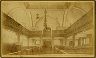
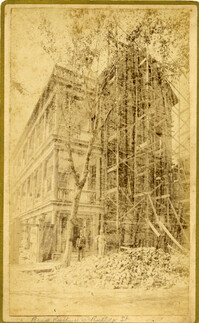
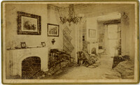
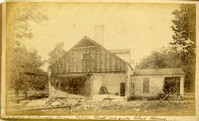
- Creator:
- Cook, Geo. L. (George L.)
- Collection:
- Charleston Museum Earthquake Photographs
- Institution:
- The Charleston Museum Archives
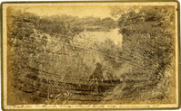
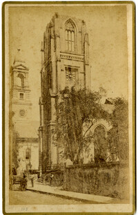
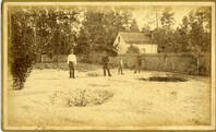
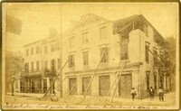
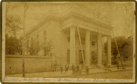
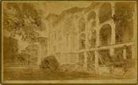
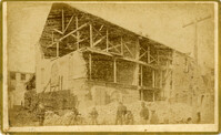
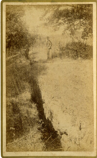
- Creator:
- Cook, Geo. L. (George L.)
- Collection:
- Charleston Museum Earthquake Photographs
- Institution:
- The Charleston Museum Archives
- Creator:
- Cook, Geo. L. (George L.)
- Collection:
- Charleston Museum Earthquake Photographs
- Institution:
- The Charleston Museum Archives
- Creator:
- Cook, Geo. L. (George L.)
- Collection:
- Charleston Museum Earthquake Photographs
- Institution:
- The Charleston Museum Archives
- Creator:
- Cook, Geo. L. (George L.)
- Collection:
- Charleston Museum Earthquake Photographs
- Institution:
- The Charleston Museum Archives
- Creator:
- Cook, Geo. L. (George L.)
- Collection:
- Charleston Museum Earthquake Photographs
- Institution:
- The Charleston Museum Archives
- Creator:
- Cook, Geo. L. (George L.)
- Collection:
- Charleston Museum Earthquake Photographs
- Institution:
- The Charleston Museum Archives
- Creator:
- Cook, Geo. L. (George L.)
- Collection:
- Charleston Museum Earthquake Photographs
- Institution:
- The Charleston Museum Archives
- Creator:
- Cook, Geo. L. (George L.)
- Collection:
- Charleston Museum Earthquake Photographs
- Institution:
- The Charleston Museum Archives
- Creator:
- Cook, Geo. L. (George L.)
- Collection:
- Charleston Museum Earthquake Photographs
- Institution:
- The Charleston Museum Archives
- Creator:
- Cook, Geo. L. (George L.)
- Collection:
- Charleston Museum Earthquake Photographs
- Institution:
- The Charleston Museum Archives
- Creator:
- Cook, Geo. L. (George L.)
- Collection:
- Charleston Museum Earthquake Photographs
- Institution:
- The Charleston Museum Archives
- Creator:
- Cook, Geo. L. (George L.)
- Collection:
- Charleston Museum Earthquake Photographs
- Institution:
- The Charleston Museum Archives
- Creator:
- Cook, Geo. L. (George L.)
- Collection:
- Charleston Museum Earthquake Photographs
- Institution:
- The Charleston Museum Archives
- Creator:
- Cook, Geo. L. (George L.)
- Collection:
- Charleston Museum Earthquake Photographs
- Institution:
- The Charleston Museum Archives
- Creator:
- Cook, Geo. L. (George L.)
- Collection:
- Charleston Museum Earthquake Photographs
- Institution:
- The Charleston Museum Archives
- Creator:
- Cook, Geo. L. (George L.)
- Collection:
- Charleston Museum Earthquake Photographs
- Institution:
- The Charleston Museum Archives
- Creator:
- Cook, Geo. L. (George L.)
- Collection:
- Charleston Museum Earthquake Photographs
- Institution:
- The Charleston Museum Archives
- Creator:
- Cook, Geo. L. (George L.)
- Collection:
- Charleston Museum Earthquake Photographs
- Institution:
- The Charleston Museum Archives
- Creator:
- Cook, Geo. L. (George L.)
- Collection:
- Charleston Museum Earthquake Photographs
- Institution:
- The Charleston Museum Archives
- Creator:
- Cook, Geo. L. (George L.)
- Collection:
- Charleston Museum Earthquake Photographs
- Institution:
- The Charleston Museum Archives
- Creator:
- Cook, Geo. L. (George L.)
- Collection:
- Charleston Museum Earthquake Photographs
- Institution:
- The Charleston Museum Archives
- Creator:
- Cook, Geo. L. (George L.)
- Collection:
- Charleston Museum Earthquake Photographs
- Institution:
- The Charleston Museum Archives
- Creator:
- Cook, Geo. L. (George L.)
- Collection:
- Charleston Museum Earthquake Photographs
- Institution:
- The Charleston Museum Archives
- Creator:
- Cook, Geo. L. (George L.)
- Collection:
- Charleston Museum Earthquake Photographs
- Institution:
- The Charleston Museum Archives
- Creator:
- Cook, Geo. L. (George L.)
- Collection:
- Charleston Museum Earthquake Photographs
- Institution:
- The Charleston Museum Archives
- Creator:
- Cook, Geo. L. (George L.)
- Collection:
- Charleston Museum Earthquake Photographs
- Institution:
- The Charleston Museum Archives
- Creator:
- Cook, Geo. L. (George L.)
- Collection:
- Charleston Museum Earthquake Photographs
- Institution:
- The Charleston Museum Archives
- Creator:
- Cook, Geo. L. (George L.)
- Collection:
- Charleston Museum Earthquake Photographs
- Institution:
- The Charleston Museum Archives
- Creator:
- Cook, Geo. L. (George L.)
- Collection:
- Charleston Museum Earthquake Photographs
- Institution:
- The Charleston Museum Archives
- Creator:
- Cook, Geo. L. (George L.)
- Collection:
- Charleston Museum Earthquake Photographs
- Institution:
- The Charleston Museum Archives
- Creator:
- Cook, Geo. L. (George L.)
- Collection:
- Charleston Museum Earthquake Photographs
- Institution:
- The Charleston Museum Archives
- Creator:
- Cook, Geo. L. (George L.)
- Collection:
- Charleston Museum Earthquake Photographs
- Institution:
- The Charleston Museum Archives
- Creator:
- Cook, Geo. L. (George L.)
- Collection:
- Charleston Museum Earthquake Photographs
- Institution:
- The Charleston Museum Archives
- Creator:
- Cook, Geo. L. (George L.)
- Collection:
- Charleston Museum Earthquake Photographs
- Institution:
- The Charleston Museum Archives
- Creator:
- Cook, Geo. L. (George L.)
- Collection:
- Charleston Museum Earthquake Photographs
- Institution:
- The Charleston Museum Archives
- Creator:
- Cook, Geo. L. (George L.)
- Collection:
- Charleston Museum Earthquake Photographs
- Institution:
- The Charleston Museum Archives
- Creator:
- Cook, Geo. L. (George L.)
- Collection:
- Charleston Museum Earthquake Photographs
- Institution:
- The Charleston Museum Archives
- Creator:
- Cook, Geo. L. (George L.)
- Collection:
- Charleston Museum Earthquake Photographs
- Institution:
- The Charleston Museum Archives
- Creator:
- Cook, Geo. L. (George L.)
- Collection:
- Charleston Museum Earthquake Photographs
- Institution:
- The Charleston Museum Archives
- Creator:
- Cook, Geo. L. (George L.)
- Collection:
- Charleston Museum Earthquake Photographs
- Institution:
- The Charleston Museum Archives
- Creator:
- Cook, Geo. L. (George L.)
- Collection:
- Charleston Museum Earthquake Photographs
- Institution:
- The Charleston Museum Archives
- Creator:
- Cook, Geo. L. (George L.)
- Collection:
- Charleston Museum Earthquake Photographs
- Institution:
- The Charleston Museum Archives
- Creator:
- Cook, Geo. L. (George L.)
- Collection:
- Charleston Museum Earthquake Photographs
- Institution:
- The Charleston Museum Archives
- Creator:
- Cook, Geo. L. (George L.)
- Collection:
- Charleston Museum Earthquake Photographs
- Institution:
- The Charleston Museum Archives
- Creator:
- Cook, Geo. L. (George L.)
- Collection:
- Charleston Museum Earthquake Photographs
- Institution:
- The Charleston Museum Archives
- Creator:
- Cook, Geo. L. (George L.)
- Collection:
- Charleston Museum Earthquake Photographs
- Institution:
- The Charleston Museum Archives
- Creator:
- Cook, Geo. L. (George L.)
- Collection:
- Charleston Museum Earthquake Photographs
- Institution:
- The Charleston Museum Archives