Search
Search Results
- Creator:
- Bacot, Julius Motte, 1859-1899
- Collection:
- Bacot Family Papers, 1752-1973
- Institution:
- South Carolina Historical Society
- Creator:
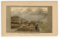
- Glazier, Willard W., 1841-1905
- Collection:
- Illustrated Newspaper Clippings, 1840-1917
- Institution:
- College of Charleston Libraries
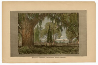
- Creator:
- Glazier, Willard W., 1841-1905
- Collection:
- Illustrated Newspaper Clippings, 1840-1917
- Institution:
- College of Charleston Libraries
- Creator:
- Stryker, William S. (William Scudder), 1838-1900
- Collection:
- Civil War Pamphlets
- Institution:
- Greenville County Library System
- Creator:
- Dr. J.C. Ayer & Co.
- Collection:
- C. Wayne Weart Apothecary Trade Cards, 1870-1920
- Institution:
- Waring Historical Library (MUSC)
- Creator:
- C.I. Hood & Co. (Lowell, Mass.)
- Collection:
- C. Wayne Weart Apothecary Trade Cards, 1870-1920
- Institution:
- Waring Historical Library (MUSC)
- Creator:
- Dr. J.C. Ayer & Co.
- Collection:
- C. Wayne Weart Apothecary Trade Cards, 1870-1920
- Institution:
- Waring Historical Library (MUSC)
- Collection:
- C. Wayne Weart Apothecary Trade Cards, 1870-1920
- Institution:
- Waring Historical Library (MUSC)
- Creator:
- Anderson, Joseph H. (Photographer)
- Collection:
- Housworth Stereographs Collection
- Institution:
- University of South Carolina. South Caroliniana Library
- Creator:
- Taylor, John C. (Photographer)
- Collection:
- Chibbaro Stereograph Collection: 186u-1997
- Institution:
- University of South Carolina. South Caroliniana Library
- Creator:
- DeSaussure, Wilmot G. (Wilmot Gibbes), 1822-1886.
- Collection:
- South Caroliniana Pamphlet Collection
- Institution:
- University of South Carolina. South Caroliniana Library
- Creator:
- Simons, S. Lewis
- Collection:
- South Caroliniana Library Map Collection
- Institution:
- University of South Carolina. South Caroliniana Library
- Collection:
- Phosphates in South Carolina, 1870-1890
- Institution:
- University of South Carolina. South Caroliniana Library
- Creator:
- Episcopal Church. Diocese of South Carolina. Convention
- Collection:
- Minutes of the Annual Conferences of the Baptist, Episcopal, Lutheran, Methodist, and Presbyterian Churches in South Carolina, 1785-1920
- Institution:
- University of South Carolina. South Caroliniana Library
- Collection:
- Primary Sources for K-12, Pilot Project
- Institution:
- University of South Carolina. South Caroliniana Library
- Collection:
- Primary Sources for K-12, Pilot Project
- Institution:
- University of South Carolina. South Caroliniana Library
- Creator:
- Wilson, Wm. E.
- Collection:
- Primary Sources for K-12, Pilot Project
- Institution:
- University of South Carolina. South Caroliniana Library
- Creator:
- Wilson, Wm. E.
- Collection:
- Primary Sources for K-12, Pilot Project
- Institution:
- University of South Carolina. South Caroliniana Library
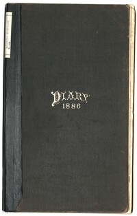
- Collection:
- Charleston Earthquake 1886
- Institution:
- University of South Carolina. South Caroliniana Library
- Creator:
- Hillers, John K., 1843-1925.
- Collection:
- Charleston Earthquake 1886
- Institution:
- University of South Carolina. South Caroliniana Library
- Creator:
- Wilson, William E., photographer.
- Collection:
- Charleston Earthquake 1886
- Institution:
- University of South Carolina. South Caroliniana Library
- Collection:
- Charleston Earthquake 1886
- Institution:
- University of South Carolina. South Caroliniana Library
- Creator:
- Hillers, John K., 1843-1925.
- Collection:
- Charleston Earthquake 1886
- Institution:
- University of South Carolina. South Caroliniana Library
- Creator:
- Hillers, John K., 1843-1925.
- Collection:
- Charleston Earthquake 1886
- Institution:
- University of South Carolina. South Caroliniana Library
- Collection:
- Charleston Earthquake 1886
- Institution:
- University of South Carolina. South Caroliniana Library
- Collection:
- Charleston Earthquake 1886
- Institution:
- University of South Carolina. South Caroliniana Library
- Collection:
- Charleston Earthquake 1886
- Institution:
- University of South Carolina. South Caroliniana Library
- Collection:
- Charleston Earthquake 1886
- Institution:
- University of South Carolina. South Caroliniana Library
- Creator:
- Hillers, John K., 1843-1925.
- Collection:
- Charleston Earthquake 1886
- Institution:
- University of South Carolina. South Caroliniana Library
- Creator:
- Hillers, John K., 1843-1925.
- Collection:
- Charleston Earthquake 1886
- Institution:
- University of South Carolina. South Caroliniana Library
- Collection:
- Charleston Earthquake 1886
- Institution:
- University of South Carolina. South Caroliniana Library
- Creator:
- Hillers, John K., 1843-1925.
- Collection:
- Charleston Earthquake 1886
- Institution:
- University of South Carolina. South Caroliniana Library
- Creator:
- Hillers, John K., 1843-1925.
- Collection:
- Charleston Earthquake 1886
- Institution:
- University of South Carolina. South Caroliniana Library
- Creator:
- Hillers, John K., 1843-1925.
- Collection:
- Charleston Earthquake 1886
- Institution:
- University of South Carolina. South Caroliniana Library
- Creator:
- Wilson, William E., photographer.
- Collection:
- Charleston Earthquake 1886
- Institution:
- University of South Carolina. South Caroliniana Library
- Collection:
- Charleston Earthquake 1886
- Institution:
- University of South Carolina. South Caroliniana Library
- Creator:
- Wilson, William E., photographer.
- Collection:
- Charleston Earthquake 1886
- Institution:
- University of South Carolina. South Caroliniana Library
- Creator:
- Hillers, John K., 1843-1925.
- Collection:
- Charleston Earthquake 1886
- Institution:
- University of South Carolina. South Caroliniana Library
- Creator:
- Hillers, John K., 1843-1925.
- Collection:
- Charleston Earthquake 1886
- Institution:
- University of South Carolina. South Caroliniana Library
- Creator:
- Hillers, John K., 1843-1925.
- Collection:
- Charleston Earthquake 1886
- Institution:
- University of South Carolina. South Caroliniana Library
- Creator:
- Hillers, John K., 1843-1925.
- Collection:
- Charleston Earthquake 1886
- Institution:
- University of South Carolina. South Caroliniana Library
- Creator:
- Cook, Geo. L. (George L.), photographer.
- Collection:
- Charleston Earthquake 1886
- Institution:
- University of South Carolina. South Caroliniana Library
- Creator:
- Cook, Geo. L. (George L.), photographer.
- Collection:
- Charleston Earthquake 1886
- Institution:
- University of South Carolina. South Caroliniana Library
- Creator:
- Cook, Geo. L. (George L.), photographer.
- Collection:
- Charleston Earthquake 1886
- Institution:
- University of South Carolina. South Caroliniana Library
- Creator:
- Cook, Geo. L. (George L.), photographer.
- Collection:
- Charleston Earthquake 1886
- Institution:
- University of South Carolina. South Caroliniana Library
- Creator:
- Cook, Geo. L. (George L.), photographer.
- Collection:
- Charleston Earthquake 1886
- Institution:
- University of South Carolina. South Caroliniana Library
- Creator:
- Cook, Geo. L. (George L.), photographer.
- Collection:
- Charleston Earthquake 1886
- Institution:
- University of South Carolina. South Caroliniana Library
- Creator:
- Cook, Geo. L. (George L.), photographer.
- Collection:
- Charleston Earthquake 1886
- Institution:
- University of South Carolina. South Caroliniana Library
- Creator:
- Cook, Geo. L. (George L.), photographer.
- Collection:
- Charleston Earthquake 1886
- Institution:
- University of South Carolina. South Caroliniana Library
- Creator:
- Cook, Geo. L. (George L.), photographer.
- Collection:
- Charleston Earthquake 1886
- Institution:
- University of South Carolina. South Caroliniana Library
- Creator:
- Hillers, John K., 1843-1925.
- Collection:
- Charleston Earthquake 1886
- Institution:
- University of South Carolina. South Caroliniana Library
- Creator:
- Hillers, John K., 1843-1925, photographer.
- Collection:
- Charleston Earthquake 1886
- Institution:
- University of South Carolina. South Caroliniana Library
- Collection:
- Charleston Earthquake 1886
- Institution:
- University of South Carolina. South Caroliniana Library
- Creator:
- Heliotype Printing Company of Boston
- Collection:
- Charleston Earthquake 1886
- Institution:
- University of South Carolina. South Caroliniana Library
- Creator:
- Heliotype Printing Company of Boston
- Collection:
- Charleston Earthquake 1886
- Institution:
- University of South Carolina. South Caroliniana Library
- Creator:
- Heliotype Printing Company of Boston
- Collection:
- Charleston Earthquake 1886
- Institution:
- University of South Carolina. South Caroliniana Library
- Creator:
- Hillers, John K., 1843-1925.
- Collection:
- Charleston Earthquake 1886
- Institution:
- University of South Carolina. South Caroliniana Library
- Creator:
- Hillers, John K., 1843-1925.
- Collection:
- Charleston Earthquake 1886
- Institution:
- University of South Carolina. South Caroliniana Library
- Creator:
- Hillers, John K., 1843-1925.
- Collection:
- Charleston Earthquake 1886
- Institution:
- University of South Carolina. South Caroliniana Library
- Creator:
- Hillers, John K., 1843-1925.
- Collection:
- Charleston Earthquake 1886
- Institution:
- University of South Carolina. South Caroliniana Library
- Creator:
- Hillers, John K., 1843-1925.
- Collection:
- Charleston Earthquake 1886
- Institution:
- University of South Carolina. South Caroliniana Library
- Creator:
- Hillers, John K., 1843-1925.
- Collection:
- Charleston Earthquake 1886
- Institution:
- University of South Carolina. South Caroliniana Library
- Creator:
- Heliotype Printing Company of Boston
- Collection:
- Charleston Earthquake 1886
- Institution:
- University of South Carolina. South Caroliniana Library
- Collection:
- Charleston Earthquake 1886
- Institution:
- University of South Carolina. South Caroliniana Library
- Creator:
- Hillers, John K., 1843-1925.
- Collection:
- Charleston Earthquake 1886
- Institution:
- University of South Carolina. South Caroliniana Library
- Creator:
- Hillers, John K., 1843-1925.
- Collection:
- Charleston Earthquake 1886
- Institution:
- University of South Carolina. South Caroliniana Library
- Creator:
- Heliotype Printing Company of Boston
- Collection:
- Charleston Earthquake 1886
- Institution:
- University of South Carolina. South Caroliniana Library
- Creator:
- Heliotype Printing Company of Boston
- Collection:
- Charleston Earthquake 1886
- Institution:
- University of South Carolina. South Caroliniana Library
- Creator:
- Heliotype Printing Company of Boston
- Collection:
- Charleston Earthquake 1886
- Institution:
- University of South Carolina. South Caroliniana Library
- Creator:
- Heliotype Printing Company of Boston
- Collection:
- Charleston Earthquake 1886
- Institution:
- University of South Carolina. South Caroliniana Library
- Creator:
- Heliotype Printing Company of Boston
- Collection:
- Charleston Earthquake 1886
- Institution:
- University of South Carolina. South Caroliniana Library
- Collection:
- Charleston Earthquake 1886
- Institution:
- University of South Carolina. South Caroliniana Library
- Creator:
- Hillers, John K., 1843-1925.
- Collection:
- Charleston Earthquake 1886
- Institution:
- University of South Carolina. South Caroliniana Library
- Creator:
- Heliotype Printing Company of Boston
- Collection:
- Charleston Earthquake 1886
- Institution:
- University of South Carolina. South Caroliniana Library
- Creator:
- Hillers, John K., 1843-1925.
- Collection:
- Charleston Earthquake 1886
- Institution:
- University of South Carolina. South Caroliniana Library
- Creator:
- Cook, Geo. L. (George L.), photographer.
- Collection:
- Charleston Earthquake 1886
- Institution:
- University of South Carolina. South Caroliniana Library
- Creator:
- Cook, Geo. L. (George L.), photographer.
- Collection:
- Charleston Earthquake 1886
- Institution:
- University of South Carolina. South Caroliniana Library
- Creator:
- Cook, Geo. L. (George L.), photographer.
- Collection:
- Charleston Earthquake 1886
- Institution:
- University of South Carolina. South Caroliniana Library
- Creator:
- Cook, Geo. L. (George L.), photographer.
- Collection:
- Charleston Earthquake 1886
- Institution:
- University of South Carolina. South Caroliniana Library
- Creator:
- Cook, Geo. L. (George L.), photographer.
- Collection:
- Charleston Earthquake 1886
- Institution:
- University of South Carolina. South Caroliniana Library
- Collection:
- Charleston Earthquake 1886
- Institution:
- University of South Carolina. South Caroliniana Library
- Creator:
- Cook, Geo. L. (George L.), photographer.
- Collection:
- Charleston Earthquake 1886
- Institution:
- University of South Carolina. South Caroliniana Library
- Creator:
- Cook, Geo. L. (George L.), photographer.
- Collection:
- Charleston Earthquake 1886
- Institution:
- University of South Carolina. South Caroliniana Library
- Creator:
- Kensington Art Studio (Brooklyn, N.Y.)
- Collection:
- Charleston Earthquake 1886
- Institution:
- University of South Carolina. South Caroliniana Library
- Creator:
- Cook, Geo. L. (George L.), photographer.
- Collection:
- Charleston Earthquake 1886
- Institution:
- University of South Carolina. South Caroliniana Library
- Creator:
- Cook, Geo. L. (George L.), photographer.
- Collection:
- Charleston Earthquake 1886
- Institution:
- University of South Carolina. South Caroliniana Library
- Creator:
- Fairchild, W. H., photographer.
- Collection:
- Charleston Earthquake 1886
- Institution:
- University of South Carolina. South Caroliniana Library
- Collection:
- Charleston Earthquake 1886
- Institution:
- University of South Carolina. South Caroliniana Library
- Creator:
- Kensington Art Studio, photographer.
- Collection:
- Charleston Earthquake 1886
- Institution:
- University of South Carolina. South Caroliniana Library
- Collection:
- Charleston Earthquake 1886
- Institution:
- University of South Carolina. South Caroliniana Library
- Collection:
- Charleston Earthquake 1886
- Institution:
- University of South Carolina. South Caroliniana Library
- Creator:
- Savannah Photograph Gallery (Ga.) and Wilson, William E., photographer.
- Collection:
- Charleston Earthquake 1886
- Institution:
- University of South Carolina. South Caroliniana Library
- Creator:
- Cook, Geo. L. (George L.), photographer.
- Collection:
- Charleston Earthquake 1886
- Institution:
- University of South Carolina. South Caroliniana Library
- Collection:
- Charleston Earthquake 1886
- Institution:
- University of South Carolina. South Caroliniana Library
- Creator:
- Cook, Geo. L. (George L.), photographer.
- Collection:
- Charleston Earthquake 1886
- Institution:
- University of South Carolina. South Caroliniana Library
- Creator:
- Cook, Geo. L. (George L.), photographer.
- Collection:
- Charleston Earthquake 1886
- Institution:
- University of South Carolina. South Caroliniana Library
- Creator:
- Wilson, William E., photographer.
- Collection:
- Charleston Earthquake 1886
- Institution:
- University of South Carolina. South Caroliniana Library
- Creator:
- Cook, Geo. L. (George L.), photographer.
- Collection:
- Charleston Earthquake 1886
- Institution:
- University of South Carolina. South Caroliniana Library