Skip to search
Skip to main content
Skip to first result
Search
Search Results
Collection:
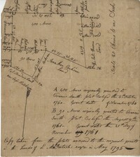
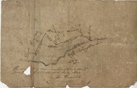
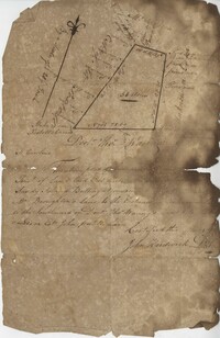
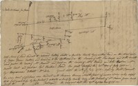
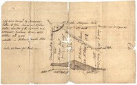
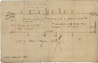
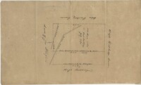
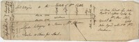
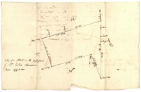
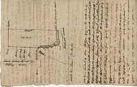
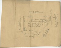
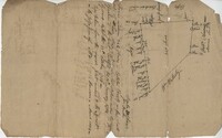
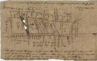
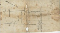
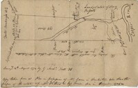
John McCrady Plats and Deeds Collection
Institution:
South Carolina Historical Society
Collection:
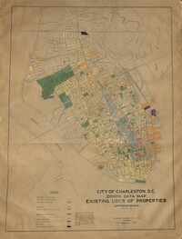
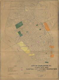
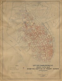
City of Charleston, SC, Report of the City Planning and Zoning Commission, Zone Maps
Institution:
City of Charleston
Collection:
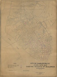
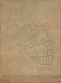
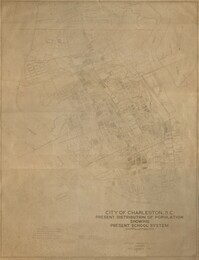
City of Charleston, SC, Report of the City Planning and Zoning Commission, Zone Maps
Institution:
City of Charleston
Collection:
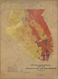
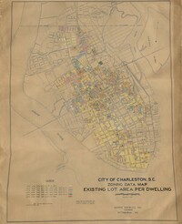
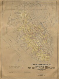
City of Charleston, SC, Report of the City Planning and Zoning Commission, Zone Maps
Institution:
City of Charleston
Collection:
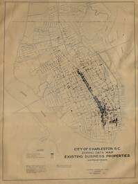
City of Charleston, SC, Report of the City Planning and Zoning Commission, Zone Maps
Institution:
City of Charleston
Collection:
City of Charleston, SC, Report of the City Planning and Zoning Commission, Zone Maps
Institution:
City of Charleston
Collection:
City of Charleston, SC, Report of the City Planning and Zoning Commission, Zone Maps
Institution:
City of Charleston
Collection:
City of Charleston, SC, Report of the City Planning and Zoning Commission, Zone Maps
Institution:
City of Charleston
Collection:
City of Charleston, SC, Report of the City Planning and Zoning Commission, Zone Maps
Institution:
City of Charleston
Collection:
City of Charleston, SC, Report of the City Planning and Zoning Commission, Zone Maps
Institution:
City of Charleston
Collection:
City of Charleston, SC, Report of the City Planning and Zoning Commission, Zone Maps
Institution:
City of Charleston
Collection:
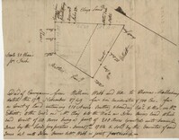
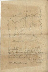
John McCrady Plats and Deeds Collection
Institution:
South Carolina Historical Society
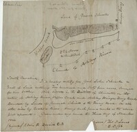
Collection:
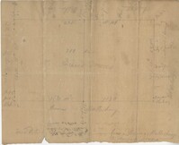
John McCrady Plats and Deeds Collection
Institution:
South Carolina Historical Society
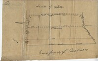
Collection:
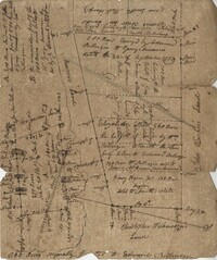
John McCrady Plats and Deeds Collection
Institution:
South Carolina Historical Society
Collection:
John McCrady Plats and Deeds Collection
Institution:
South Carolina Historical Society
Collection:
John McCrady Plats and Deeds Collection
Institution:
South Carolina Historical Society
Collection:
John McCrady Plats and Deeds Collection
Institution:
South Carolina Historical Society
Collection:
John McCrady Plats and Deeds Collection
Institution:
South Carolina Historical Society
Collection:
John McCrady Plats and Deeds Collection
Institution:
South Carolina Historical Society
Collection:
John McCrady Plats and Deeds Collection
Institution:
South Carolina Historical Society
Collection:
John McCrady Plats and Deeds Collection
Institution:
South Carolina Historical Society
Collection:
John McCrady Plats and Deeds Collection
Institution:
South Carolina Historical Society
Collection:
John McCrady Plats and Deeds Collection
Institution:
South Carolina Historical Society
Collection:
John McCrady Plats and Deeds Collection
Institution:
South Carolina Historical Society
Collection:
John McCrady Plats and Deeds Collection
Institution:
South Carolina Historical Society
Collection:
John McCrady Plats and Deeds Collection
Institution:
South Carolina Historical Society
Collection:
John McCrady Plats and Deeds Collection
Institution:
South Carolina Historical Society
Collection:
John McCrady Plats and Deeds Collection
Institution:
South Carolina Historical Society
Collection:
John McCrady Plats and Deeds Collection
Institution:
South Carolina Historical Society
Collection:
John McCrady Plats and Deeds Collection
Institution:
South Carolina Historical Society
Collection:
John McCrady Plats and Deeds Collection
Institution:
South Carolina Historical Society
Collection:
John McCrady Plats and Deeds Collection
Institution:
South Carolina Historical Society
Collection:
John McCrady Plats and Deeds Collection
Institution:
South Carolina Historical Society
Collection:
John McCrady Plats and Deeds Collection
Institution:
South Carolina Historical Society
Collection:
John McCrady Plats and Deeds Collection
Institution:
South Carolina Historical Society
Collection:
John McCrady Plats and Deeds Collection
Institution:
South Carolina Historical Society
Creator:
United States. Army. Corps of Engineers
Collection:
Topographical Maps of South Carolina, 1888 -1975
Institution:
University of South Carolina. Government Information and Maps Department
Creator:
United States. Army. Corps of Engineers
Collection:
Topographical Maps of South Carolina, 1888 -1975
Institution:
University of South Carolina. Government Information and Maps Department
Creator:
United States. Army. Corps of Engineers
Collection:
Topographical Maps of South Carolina, 1888 -1975
Institution:
University of South Carolina. Government Information and Maps Department
Creator:
United States. Army. Corps of Engineers
Collection:
Topographical Maps of South Carolina, 1888 -1975
Institution:
University of South Carolina. Government Information and Maps Department
Creator:
United States. Army. Corps of Engineers
Collection:
Topographical Maps of South Carolina, 1888 -1975
Institution:
University of South Carolina. Government Information and Maps Department
Creator:
United States. Army. Corps of Engineers
Collection:
Topographical Maps of South Carolina, 1888 -1975
Institution:
University of South Carolina. Government Information and Maps Department
Creator:
United States. Army. Corps of Engineers
Collection:
Topographical Maps of South Carolina, 1888 -1975
Institution:
University of South Carolina. Government Information and Maps Department
Creator:
United States. Army. Corps of Engineers
Collection:
Topographical Maps of South Carolina, 1888 -1975
Institution:
University of South Carolina. Government Information and Maps Department
Creator:
United States. Army. Corps of Engineers
Collection:
Topographical Maps of South Carolina, 1888 -1975
Institution:
University of South Carolina. Government Information and Maps Department
Creator:
Berkeley-Charleston-Dorchester Regional Planning Council
Collection:
South Caroliniana Library Map Collection
Institution:
University of South Carolina. South Caroliniana Library
Creator:
Vignoles, Charles Blacker, 1793-1875
Collection:
South Caroliniana Library Map Collection
Institution:
University of South Carolina. South Caroliniana Library
Creator:
United States Coast Survey (Cartographer)
Collection:
South Caroliniana Library Map Collection
Institution:
University of South Carolina. South Caroliniana Library
Collection:
South Caroliniana Library Map Collection
Institution:
University of South Carolina. South Caroliniana Library
Collection:
South Caroliniana Library Map Collection
Institution:
University of South Carolina. South Caroliniana Library
Collection:
South Caroliniana Library Map Collection
Institution:
University of South Carolina. South Caroliniana Library
Collection:
South Caroliniana Library Map Collection
Institution:
University of South Carolina. South Caroliniana Library
Collection:
South Caroliniana Library Map Collection
Institution:
University of South Carolina. South Caroliniana Library
Collection:
South Caroliniana Library Map Collection
Institution:
University of South Carolina. South Caroliniana Library
Collection:
South Caroliniana Library Map Collection
Institution:
University of South Carolina. South Caroliniana Library
Collection:
South Caroliniana Library Map Collection
Institution:
University of South Carolina. South Caroliniana Library
Collection:
South Caroliniana Library Map Collection
Institution:
University of South Carolina. South Caroliniana Library
Collection:
South Caroliniana Library Map Collection
Institution:
University of South Carolina. South Caroliniana Library
Institution:
University of South Carolina. South Caroliniana Library
Institution:
University of South Carolina. South Caroliniana Library
Collection:
South Caroliniana Library Map Collection
Institution:
University of South Carolina. South Caroliniana Library
Collection:
South Caroliniana Library Map Collection
Institution:
University of South Carolina. South Caroliniana Library
Collection:
South Caroliniana Library Map Collection
Institution:
University of South Carolina. South Caroliniana Library
Creator:
Marshall, R. B. (Robert Bradford), 1867-1949 (Geographer) and Herron, W. H. (William Harrison), 1865- (Geographer)
Collection:
South Caroliniana Library Map Collection
Institution:
University of South Carolina. South Caroliniana Library
Creator:
Bumstead, Albert H. (Albert Hoit), 1875-1940 (Cartographer)
Collection:
South Caroliniana Library Map Collection
Institution:
University of South Carolina. South Caroliniana Library
Collection:
South Caroliniana Library Map Collection
Institution:
University of South Carolina. South Caroliniana Library
Collection:
South Caroliniana Library Map Collection
Institution:
University of South Carolina. South Caroliniana Library
Collection:
South Caroliniana Library Map Collection
Institution:
University of South Carolina. South Caroliniana Library
Collection:
South Caroliniana Library Map Collection
Institution:
University of South Carolina. South Caroliniana Library
Creator:
Simons, S. Lewis
Collection:
South Caroliniana Library Map Collection
Institution:
University of South Carolina. South Caroliniana Library
Collection:
South Caroliniana Library Map Collection
Institution:
University of South Carolina. South Caroliniana Library
Collection:
South Caroliniana Library Map Collection
Institution:
University of South Carolina. South Caroliniana Library
Collection:
South Caroliniana Library Map Collection
Institution:
University of South Carolina. South Caroliniana Library
Collection:
South Caroliniana Library Map Collection
Institution:
University of South Carolina. South Caroliniana Library
Collection:
South Caroliniana Library Map Collection
Institution:
University of South Carolina. South Caroliniana Library
Collection:
South Caroliniana Library Map Collection
Institution:
University of South Carolina. South Caroliniana Library
Collection:
South Caroliniana Library Map Collection
Institution:
University of South Carolina. South Caroliniana Library
Creator:
Bartholomew, John, 1831-1893
Collection:
South Caroliniana Library Map Collection
Institution:
University of South Carolina. South Caroliniana Library
Creator:
Mouzon, Henry and Cook, James, 1728-1779
Collection:
South Caroliniana Library Map Collection
Institution:
University of South Carolina. South Caroliniana Library
Creator:
Bowen & Co. (Lithographer)
Collection:
South Caroliniana Library Map Collection
Institution:
University of South Carolina. South Caroliniana Library
Collection:
South Caroliniana Library Map Collection
Institution:
University of South Carolina. South Caroliniana Library
Creator:
Willenbu?cher, Eugene and Bowen & Co. (Lithographer)
Collection:
South Caroliniana Library Map Collection
Institution:
University of South Carolina. South Caroliniana Library
Creator:
Colton, G. Woolworth (George Woolworth), 1827-1901
Collection:
South Caroliniana Library Map Collection
Institution:
University of South Carolina. South Caroliniana Library
Creator:
Bowen & Co. (Lithographer)
Collection:
South Caroliniana Library Map Collection
Institution:
University of South Carolina. South Caroliniana Library
Collection:
South Caroliniana Library Map Collection
Institution:
University of South Carolina. South Caroliniana Library
Creator:
Bache, A.D. (Alexander Dallas),1806-1867, Boutelle, C.O. (Charles Otis), Wainwright, S.A., Craven, Tunis A. M., 1813-1864, Maffitt, John Newland, 1819-1886, Farquhar, G. (Cartographer), Williams, L.D. (Cartographer), Smith, W. (Engraver), and Yeager, E. (Edward) (Engraver)
Collection:
South Caroliniana Library Map Collection
Institution:
University of South Carolina. South Caroliniana Library
Creator:
Fenner, Sears & Co. (Printer and Engraver)
Collection:
South Caroliniana Library Map Collection
Institution:
University of South Carolina. South Caroliniana Library
Collection:
South Caroliniana Library Map Collection
Institution:
University of South Carolina. South Caroliniana Library
Creator:
Eliason, William Alexander, -1839
Collection:
South Caroliniana Library Map Collection
Institution:
University of South Carolina. South Caroliniana Library
Creator:
Colton, G. Woolworth (George Woolworth), 1827-1901
Collection:
South Caroliniana Library Map Collection
Institution:
University of South Carolina. South Caroliniana Library
Creator:
Confederate States of America. Army, Confederate States of America. Army. Corps of Engineers, Walker, William A., Johnson, John, Echols, William H., -1909, and Key, John Ross, 1832-1920
Collection:
South Caroliniana Library Map Collection
Institution:
University of South Carolina. South Caroliniana Library
Creator:
Bache, A.D. (Alexander Douglass),1806-1867, Maffitt, John Newland, 1819-1886, Boschke, A. (Cartographer), Maedel, A. (Adolph) (Engraver), and Knight, C. A.
Collection:
South Caroliniana Library Map Collection
Institution:
University of South Carolina. South Caroliniana Library
Creator:
Colton, J.H. (Joseph Hutchins), 1800-1893
Collection:
South Caroliniana Library Map Collection
Institution:
University of South Carolina. South Caroliniana Library
Collection:
South Caroliniana Library Map Collection
Institution:
University of South Carolina. South Caroliniana Library
Collection:
South Caroliniana Library Map Collection
Institution:
University of South Carolina. South Caroliniana Library
Collection:
South Caroliniana Library Map Collection
Institution:
University of South Carolina. South Caroliniana Library
Creator:
Bien, Julius, 1826-1909 (Lithographer)
Collection:
South Caroliniana Library Map Collection
Institution:
University of South Carolina. South Caroliniana Library
Creator:
Colton, G. Woolworth (George Woolworth), 1827-1901
Collection:
South Caroliniana Library Map Collection
Institution:
University of South Carolina. South Caroliniana Library
Collection:
South Caroliniana Library Map Collection
Institution:
University of South Carolina. South Caroliniana Library
Creator:
Colton, J.H. (Joseph Hutchins), 1800-1893
Collection:
South Caroliniana Library Map Collection
Institution:
University of South Carolina. South Caroliniana Library