Search
Search Results
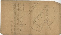
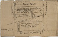
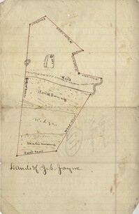
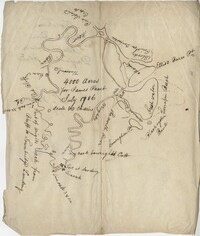
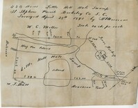
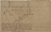
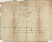
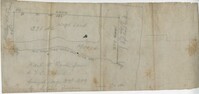
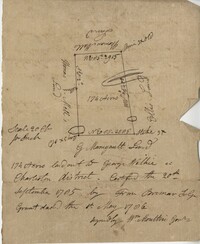
- Collection:
- John McCrady Plats and Deeds Collection
- Institution:
- South Carolina Historical Society
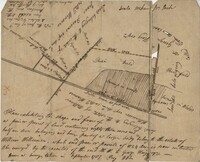
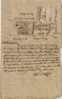
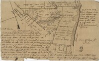
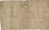
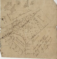
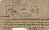
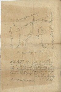
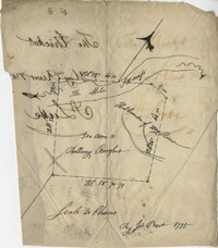
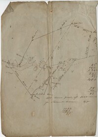
- Collection:
- John McCrady Plats and Deeds Collection
- Institution:
- South Carolina Historical Society
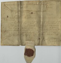
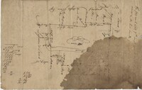
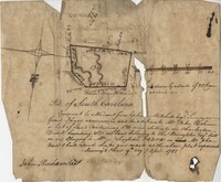
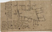
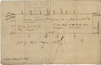
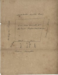
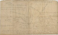
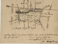
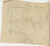
- Collection:
- John McCrady Plats and Deeds Collection
- Institution:
- South Carolina Historical Society
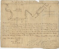
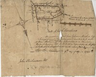
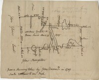
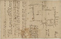
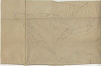
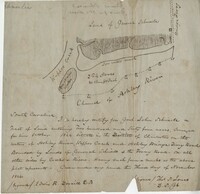
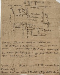
- Collection:
- John McCrady Plats and Deeds Collection
- Institution:
- South Carolina Historical Society
- Collection:
- John McCrady Plats and Deeds Collection
- Institution:
- South Carolina Historical Society
- Collection:
- John McCrady Plats and Deeds Collection
- Institution:
- South Carolina Historical Society
- Collection:
- John McCrady Plats and Deeds Collection
- Institution:
- South Carolina Historical Society
- Collection:
- John McCrady Plats and Deeds Collection
- Institution:
- South Carolina Historical Society
- Collection:
- John McCrady Plats and Deeds Collection
- Institution:
- South Carolina Historical Society
- Collection:
- John McCrady Plats and Deeds Collection
- Institution:
- South Carolina Historical Society
- Collection:
- John McCrady Plats and Deeds Collection
- Institution:
- South Carolina Historical Society
- Collection:
- John McCrady Plats and Deeds Collection
- Institution:
- South Carolina Historical Society
- Collection:
- John McCrady Plats and Deeds Collection
- Institution:
- South Carolina Historical Society
- Collection:
- John McCrady Plats and Deeds Collection
- Institution:
- South Carolina Historical Society
- Collection:
- John McCrady Plats and Deeds Collection
- Institution:
- South Carolina Historical Society
- Collection:
- John McCrady Plats and Deeds Collection
- Institution:
- South Carolina Historical Society
- Collection:
- John McCrady Plats and Deeds Collection
- Institution:
- South Carolina Historical Society
- Collection:
- John McCrady Plats and Deeds Collection
- Institution:
- South Carolina Historical Society
- Collection:
- John McCrady Plats and Deeds Collection
- Institution:
- South Carolina Historical Society
- Collection:
- John McCrady Plats and Deeds Collection
- Institution:
- South Carolina Historical Society
- Collection:
- John McCrady Plats and Deeds Collection
- Institution:
- South Carolina Historical Society
- Collection:
- John McCrady Plats and Deeds Collection
- Institution:
- South Carolina Historical Society
- Collection:
- John McCrady Plats and Deeds Collection
- Institution:
- South Carolina Historical Society
- Collection:
- John McCrady Plats and Deeds Collection
- Institution:
- South Carolina Historical Society
- Collection:
- John McCrady Plats and Deeds Collection
- Institution:
- South Carolina Historical Society
- Collection:
- John McCrady Plats and Deeds Collection
- Institution:
- South Carolina Historical Society
- Collection:
- John McCrady Plats and Deeds Collection
- Institution:
- South Carolina Historical Society
- Collection:
- John McCrady Plats and Deeds Collection
- Institution:
- South Carolina Historical Society
- Collection:
- John McCrady Plats and Deeds Collection
- Institution:
- South Carolina Historical Society
- Collection:
- John McCrady Plats and Deeds Collection
- Institution:
- South Carolina Historical Society
- Collection:
- John McCrady Plats and Deeds Collection
- Institution:
- South Carolina Historical Society
- Collection:
- John McCrady Plats and Deeds Collection
- Institution:
- South Carolina Historical Society
- Collection:
- John McCrady Plats and Deeds Collection
- Institution:
- South Carolina Historical Society
- Collection:
- John McCrady Plats and Deeds Collection
- Institution:
- South Carolina Historical Society
- Collection:
- John McCrady Plats and Deeds Collection
- Institution:
- South Carolina Historical Society
- Collection:
- John McCrady Plats and Deeds Collection
- Institution:
- South Carolina Historical Society
- Collection:
- John McCrady Plats and Deeds Collection
- Institution:
- South Carolina Historical Society
- Collection:
- John McCrady Plats and Deeds Collection
- Institution:
- South Carolina Historical Society
- Collection:
- John McCrady Plats and Deeds Collection
- Institution:
- South Carolina Historical Society
- Collection:
- John McCrady Plats and Deeds Collection
- Institution:
- South Carolina Historical Society
- Collection:
- John McCrady Plats and Deeds Collection
- Institution:
- South Carolina Historical Society
- Collection:
- John McCrady Plats and Deeds Collection
- Institution:
- South Carolina Historical Society
- Collection:
- John McCrady Plats and Deeds Collection
- Institution:
- South Carolina Historical Society
- Collection:
- John McCrady Plats and Deeds Collection
- Institution:
- South Carolina Historical Society
- Collection:
- John McCrady Plats and Deeds Collection
- Institution:
- South Carolina Historical Society
- Collection:
- John McCrady Plats and Deeds Collection
- Institution:
- South Carolina Historical Society
- Collection:
- John McCrady Plats and Deeds Collection
- Institution:
- South Carolina Historical Society
- Collection:
- John McCrady Plats and Deeds Collection
- Institution:
- South Carolina Historical Society
- Collection:
- John McCrady Plats and Deeds Collection
- Institution:
- South Carolina Historical Society
- Collection:
- John McCrady Plats and Deeds Collection
- Institution:
- South Carolina Historical Society