Skip to search
Skip to main content
Skip to first result
Search
Search Results
Collection:
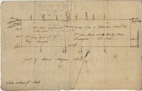
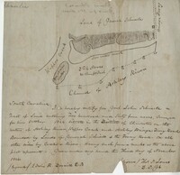
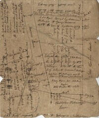
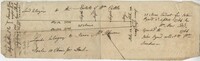
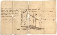
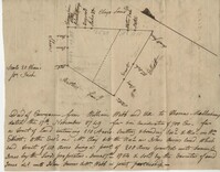
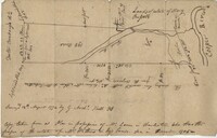
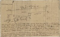
John McCrady Plats and Deeds Collection
Institution:
South Carolina Historical Society
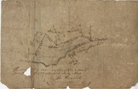
Collection:
John McCrady Plats and Deeds Collection
Institution:
South Carolina Historical Society
Creator:
United States. Army. Corps of Engineers
Collection:
Topographical Maps of South Carolina, 1888 -1975
Institution:
University of South Carolina. Government Information and Maps Department
Creator:
United States. Army. Corps of Engineers
Collection:
Topographical Maps of South Carolina, 1888 -1975
Institution:
University of South Carolina. Government Information and Maps Department
Creator:
United States. Army. Corps of Engineers
Collection:
Topographical Maps of South Carolina, 1888 -1975
Institution:
University of South Carolina. Government Information and Maps Department
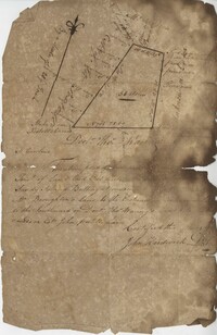
Collection:
John McCrady Plats and Deeds Collection
Institution:
South Carolina Historical Society
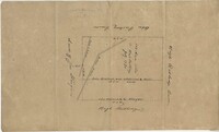
Collection:
John McCrady Plats and Deeds Collection
Institution:
South Carolina Historical Society
Collection:
John McCrady Plats and Deeds Collection
Institution:
South Carolina Historical Society
Collection:
John McCrady Plats and Deeds Collection
Institution:
South Carolina Historical Society
Creator:
Bartholomew, John, 1831-1893
Collection:
South Caroliniana Library Map Collection
Institution:
University of South Carolina. South Caroliniana Library
Creator:
Bartholomew, John, 1831-1893 (Cartographer)
Collection:
South Caroliniana Library Map Collection
Institution:
University of South Carolina. South Caroliniana Library
Creator:
McNally, Francis (Compiler)
Collection:
South Caroliniana Library Map Collection
Institution:
University of South Carolina. South Caroliniana Library
Creator:
Conder, Thomas 1746 or 1747-1831 (Sculptor)
Collection:
South Caroliniana Library Map Collection
Institution:
University of South Carolina. South Caroliniana Library
Creator:
Mitchell, S. Augustus (Samuel Augustus), 1792-1868 (Geographer)
Collection:
South Caroliniana Library Map Collection
Institution:
University of South Carolina. South Caroliniana Library
Creator:
Young, J. H. (James Hamilton) and Dankworth, Frederick, approximately 1804- (Engraver)
Collection:
South Caroliniana Library Map Collection
Institution:
University of South Carolina. South Caroliniana Library
Creator:
Moll, Herman, -1732
Collection:
South Caroliniana Library Map Collection
Institution:
University of South Carolina. South Caroliniana Library
Creator:
Cooper, Robert, active 1795-1836 (Cartographer)
Collection:
South Caroliniana Library Map Collection
Institution:
University of South Carolina. South Caroliniana Library
Collection:
South Caroliniana Library Map Collection
Institution:
University of South Carolina. South Caroliniana Library
Collection:
South Caroliniana Library Map Collection
Institution:
University of South Carolina. South Caroliniana Library
Collection:
John McCrady Plats and Deeds Collection
Institution:
South Carolina Historical Society
Collection:
South Caroliniana Library Map Collection
Institution:
University of South Carolina. South Caroliniana Library
Creator:
Schuck-Kolben, R. E.
Collection:
Hurricane Hugo Elevation Maps
Institution:
University of South Carolina. Government Information and Maps Department
Creator:
Schuck-Kolben, R. E.
Collection:
Hurricane Hugo Elevation Maps
Institution:
University of South Carolina. Government Information and Maps Department
Creator:
Schuck-Kolben, R. E.
Collection:
Hurricane Hugo Elevation Maps
Institution:
University of South Carolina. Government Information and Maps Department
Creator:
Schuck-Kolben, R. E.
Collection:
Hurricane Hugo Elevation Maps
Institution:
University of South Carolina. Government Information and Maps Department
Creator:
Schuck-Kolben, R. E.
Collection:
Hurricane Hugo Elevation Maps
Institution:
University of South Carolina. Government Information and Maps Department
Creator:
Schuck-Kolben, R. E.
Collection:
Hurricane Hugo Elevation Maps
Institution:
University of South Carolina. Government Information and Maps Department
Creator:
Schuck-Kolben, R. E.
Collection:
Hurricane Hugo Elevation Maps
Institution:
University of South Carolina. Government Information and Maps Department
Creator:
Schuck-Kolben, R. E.
Collection:
Hurricane Hugo Elevation Maps
Institution:
University of South Carolina. Government Information and Maps Department
Creator:
Schuck-Kolben, R. E.
Collection:
Hurricane Hugo Elevation Maps
Institution:
University of South Carolina. Government Information and Maps Department
Creator:
Schuck-Kolben, R. E.
Collection:
Hurricane Hugo Elevation Maps
Institution:
University of South Carolina. Government Information and Maps Department
Creator:
Schuck-Kolben, R. E.
Collection:
Hurricane Hugo Elevation Maps
Institution:
University of South Carolina. Government Information and Maps Department
Creator:
Schuck-Kolben, R. E.
Collection:
Hurricane Hugo Elevation Maps
Institution:
University of South Carolina. Government Information and Maps Department
Creator:
Schuck-Kolben, R. E.
Collection:
Hurricane Hugo Elevation Maps
Institution:
University of South Carolina. Government Information and Maps Department
Creator:
Schuck-Kolben, R. E.
Collection:
Hurricane Hugo Elevation Maps
Institution:
University of South Carolina. Government Information and Maps Department
Creator:
Schuck-Kolben, R. E.
Collection:
Hurricane Hugo Elevation Maps
Institution:
University of South Carolina. Government Information and Maps Department
Creator:
Schuck-Kolben, R. E.
Collection:
Hurricane Hugo Elevation Maps
Institution:
University of South Carolina. Government Information and Maps Department
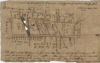
Collection:
John McCrady Plats and Deeds Collection
Institution:
South Carolina Historical Society
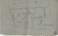
Collection:
John McCrady Plats and Deeds Collection
Institution:
South Carolina Historical Society
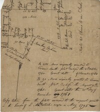
Collection:
John McCrady Plats and Deeds Collection
Institution:
South Carolina Historical Society
Creator:
Walker & Abernethie
Collection:
South Caroliniana Library Map Collection
Institution:
University of South Carolina. South Caroliniana Library
Creator:
Marshall, R. B. (Robert Bradford), 1867-1949 (Geographer) and Herron, W. H. (William Harrison), 1865- (Geographer)
Collection:
South Caroliniana Library Map Collection
Institution:
University of South Carolina. South Caroliniana Library
Collection:
South Caroliniana Library Map Collection
Institution:
University of South Carolina. South Caroliniana Library
Collection:
South Caroliniana Library Map Collection
Institution:
University of South Carolina. South Caroliniana Library
Creator:
Colton, J.H. (Joseph Hutchins), 1800-1893
Collection:
South Caroliniana Library Map Collection
Institution:
University of South Carolina. South Caroliniana Library
Collection:
South Caroliniana Library Map Collection
Institution:
University of South Carolina. South Caroliniana Library
Creator:
United States Coast Survey (Cartographer)
Collection:
South Caroliniana Library Map Collection
Institution:
University of South Carolina. South Caroliniana Library
Creator:
Eliason, William Alexander, -1839
Collection:
South Caroliniana Library Map Collection
Institution:
University of South Carolina. South Caroliniana Library
Creator:
Eliason, William Alexander, -1839
Collection:
South Caroliniana Library Map Collection
Institution:
University of South Carolina. South Caroliniana Library
Creator:
Macomb, Alexander, 1782-1841 (Topographer)
Collection:
South Caroliniana Library Map Collection
Institution:
University of South Carolina. South Caroliniana Library
Creator:
Williams, W. A., active 19th century
Collection:
South Caroliniana Library Map Collection
Institution:
University of South Carolina. South Caroliniana Library
Creator:
Williams, W. A., active 19th century
Collection:
South Caroliniana Library Map Collection
Institution:
University of South Carolina. South Caroliniana Library
Creator:
Williams, W. A., active 19th century (Cartographer)
Collection:
South Caroliniana Library Map Collection
Institution:
University of South Carolina. South Caroliniana Library
Creator:
United States Coast Survey
Collection:
South Caroliniana Library Map Collection
Institution:
University of South Carolina. South Caroliniana Library
Creator:
United States Coast Survey (Cartographer)
Collection:
South Caroliniana Library Map Collection
Institution:
University of South Carolina. South Caroliniana Library
Creator:
United States Coast Survey (Cartographer)
Collection:
South Caroliniana Library Map Collection
Institution:
University of South Carolina. South Caroliniana Library
Collection:
South Caroliniana Library Map Collection
Institution:
University of South Carolina. South Caroliniana Library
Collection:
South Caroliniana Library Map Collection
Institution:
University of South Carolina. South Caroliniana Library
Collection:
South Caroliniana Library Map Collection
Institution:
University of South Carolina. South Caroliniana Library
Creator:
Berkeley-Charleston-Dorchester Regional Planning Council
Collection:
South Caroliniana Library Map Collection
Institution:
University of South Carolina. South Caroliniana Library
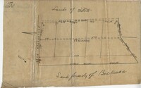
Collection:
John McCrady Plats and Deeds Collection
Institution:
South Carolina Historical Society
Collection:
John McCrady Plats and Deeds Collection
Institution:
South Carolina Historical Society
Collection:
John McCrady Plats and Deeds Collection
Institution:
South Carolina Historical Society
Creator:
Sanborn Fire Insurance Map Company
Collection:
Sanborn Fire Insurance Maps of South Carolina
Institution:
University of South Carolina. South Caroliniana Library
Creator:
Sanborn Fire Insurance Map Company
Collection:
Sanborn Fire Insurance Maps of South Carolina
Institution:
University of South Carolina. South Caroliniana Library
Collection:
South Caroliniana Library Map Collection
Institution:
University of South Carolina. South Caroliniana Library
Creator:
Bache, A.D. (Alexander Dallas),1806-1867, Boutelle, C.O. (Charles Otis), Wainwright, S.A., Craven, Tunis A. M., 1813-1864, Maffitt, John Newland, 1819-1886, Farquhar, G. (Cartographer), Williams, L.D. (Cartographer), Smith, W. (Engraver), and Yeager, E. (Edward) (Engraver)
Collection:
South Caroliniana Library Map Collection
Institution:
University of South Carolina. South Caroliniana Library
Creator:
United States Coast Survey (Cartographer)
Collection:
South Caroliniana Library Map Collection
Institution:
University of South Carolina. South Caroliniana Library
Collection:
South Caroliniana Library Map Collection
Institution:
University of South Carolina. South Caroliniana Library
Collection:
John McCrady Plats and Deeds Collection
Institution:
South Carolina Historical Society
Collection:
John McCrady Plats and Deeds Collection
Institution:
South Carolina Historical Society
Collection:
John McCrady Plats and Deeds Collection
Institution:
South Carolina Historical Society
Collection:
John McCrady Plats and Deeds Collection
Institution:
South Carolina Historical Society
Collection:
John McCrady Plats and Deeds Collection
Institution:
South Carolina Historical Society
Collection:
John McCrady Plats and Deeds Collection
Institution:
South Carolina Historical Society
Collection:
John McCrady Plats and Deeds Collection
Institution:
South Carolina Historical Society
Collection:
John McCrady Plats and Deeds Collection
Institution:
South Carolina Historical Society
Collection:
South Caroliniana Library Map Collection
Institution:
University of South Carolina. South Caroliniana Library
Collection:
South Caroliniana Library Map Collection
Institution:
University of South Carolina. South Caroliniana Library
Creator:
Yeager, Joseph approximately 1792-1859 (Engraver)
Collection:
South Caroliniana Library Map Collection
Institution:
University of South Carolina. South Caroliniana Library
Creator:
Lewis, Samuel, 1753 or 1754-1822 (Cartographer)
Collection:
South Caroliniana Library Map Collection
Institution:
University of South Carolina. South Caroliniana Library
Creator:
Abernethie (Engraver)
Collection:
South Caroliniana Library Map Collection
Institution:
University of South Carolina. South Caroliniana Library
Creator:
Faden, William, 1749-1836 (engraver)
Collection:
South Caroliniana Library Map Collection
Institution:
University of South Carolina. South Caroliniana Library
Creator:
Faden, William, 1749-1836 (engraver)
Collection:
South Caroliniana Library Map Collection
Institution:
University of South Carolina. South Caroliniana Library
Creator:
Faden, William, 1749-1836 (engraver)
Collection:
South Caroliniana Library Map Collection
Institution:
University of South Carolina. South Caroliniana Library
Creator:
Faden, William, 1749-1836 (engraver)
Collection:
South Caroliniana Library Map Collection
Institution:
University of South Carolina. South Caroliniana Library
Creator:
Gilbert, Bradford L. (Bradford Lee), 1853-1911
Collection:
South Caroliniana Library Map Collection
Institution:
University of South Carolina. South Caroliniana Library
Creator:
Senf, John Christian
Collection:
South Caroliniana Library Map Collection
Institution:
University of South Carolina. South Caroliniana Library
Creator:
United States. War Dept.
Collection:
South Carolina and the Civil War
Institution:
University of South Carolina. South Caroliniana Library
Collection:
South Caroliniana Library Map Collection
Institution:
University of South Carolina. South Caroliniana Library
Collection:
South Caroliniana Library Map Collection
Institution:
University of South Carolina. South Caroliniana Library
Collection:
South Caroliniana Library Map Collection
Institution:
University of South Carolina. South Caroliniana Library
Collection:
South Caroliniana Library Map Collection
Institution:
University of South Carolina. South Caroliniana Library
Creator:
France. Dépôt des cartes et plans de la marine
Collection:
South Caroliniana Library Map Collection
Institution:
University of South Carolina. South Caroliniana Library
Creator:
Woodbridge, William C. (William Channing), 1794-1845 (Cartographer)
Collection:
South Caroliniana Library Map Collection
Institution:
University of South Carolina. South Caroliniana Library
Collection:
John McCrady Plats and Deeds Collection
Institution:
South Carolina Historical Society
Creator:
Bowen, Emanuel, -1767
Collection:
South Caroliniana Library Map Collection
Institution:
University of South Carolina. South Caroliniana Library
Creator:
Perry, George T.
Collection:
South Caroliniana Library Map Collection
Institution:
University of South Carolina. South Caroliniana Library
Collection:
South Caroliniana Library Map Collection
Institution:
University of South Carolina. South Caroliniana Library
Creator:
Mitchell, S. Augustus, Jr. (Samuel Augustus) (Cartographer)
Collection:
South Caroliniana Library Map Collection
Institution:
University of South Carolina. South Caroliniana Library