Skip to search
Skip to main content
Skip to first result
Search
Search Results
Creator:
Bache, A.D. (Alexander Dallas), 1806-1867, Boutelle, C.O. (Charles Otis), Wise, George D. (George Douglas), 1831-1898, Maffitt, John Newland, 1819-1886, and [Davidson, George]
Collection:
South Caroliniana Library Map Collection
Institution:
University of South Carolina. South Caroliniana Library
Creator:
Bache, A.D. (Alexander Dallas), 1806-1867, Boutelle, C.O. (Charles Otis), Wise, George D. (George Douglas), 1831-1898, Maffitt, John Newland, 1819-1886, Mechlin, J.R.P., Hergesheimer, E. (Edwin), Woodward, E.F., Oehlschlager, T.H., and [Davidson, George]
Collection:
South Caroliniana Library Map Collection
Institution:
University of South Carolina. South Caroliniana Library
Creator:
United States. Army. Corps of Engineers
Collection:
Topographical Maps of South Carolina, 1888 -1975
Institution:
University of South Carolina. Government Information and Maps Department
Creator:
United States. Army. Corps of Engineers
Collection:
Topographical Maps of South Carolina, 1888 -1975
Institution:
University of South Carolina. Government Information and Maps Department
Creator:
United States. Army. Corps of Engineers
Collection:
Topographical Maps of South Carolina, 1888 -1975
Institution:
University of South Carolina. Government Information and Maps Department
Creator:
United States Coast Survey
Collection:
South Caroliniana Library Map Collection
Institution:
University of South Carolina. South Caroliniana Library
Creator:
South Carolina Department of Transportation
Collection:
South Carolina Department of Transportation County Road Maps
Institution:
University of South Carolina. Government Information and Maps Department
Creator:
South Carolina Department of Transportation
Collection:
South Carolina Department of Transportation County Road Maps
Institution:
University of South Carolina. Government Information and Maps Department
Creator:
South Carolina Department of Transportation
Collection:
South Carolina Department of Transportation County Road Maps
Institution:
University of South Carolina. Government Information and Maps Department
Creator:
South Carolina Department of Transportation
Collection:
South Carolina Department of Transportation County Road Maps
Institution:
University of South Carolina. Government Information and Maps Department
Creator:
South Carolina Department of Transportation
Collection:
South Carolina Department of Transportation County Road Maps
Institution:
University of South Carolina. Government Information and Maps Department
Creator:
South Carolina Department of Transportation
Collection:
South Carolina Department of Transportation County Road Maps
Institution:
University of South Carolina. Government Information and Maps Department
Creator:
South Carolina Department of Transportation
Collection:
South Carolina Department of Transportation County Road Maps
Institution:
University of South Carolina. Government Information and Maps Department
Creator:
South Carolina Department of Transportation
Collection:
South Carolina Department of Transportation County Road Maps
Institution:
University of South Carolina. Government Information and Maps Department
Creator:
South Carolina Department of Transportation
Collection:
South Carolina Department of Transportation County Road Maps
Institution:
University of South Carolina. Government Information and Maps Department
Creator:
South Carolina Department of Transportation
Collection:
South Carolina Department of Transportation County Road Maps
Institution:
University of South Carolina. Government Information and Maps Department
Creator:
South Carolina Department of Transportation
Collection:
South Carolina Department of Transportation County Road Maps
Institution:
University of South Carolina. Government Information and Maps Department
Creator:
South Carolina Department of Transportation
Collection:
South Carolina Department of Transportation County Road Maps
Institution:
University of South Carolina. Government Information and Maps Department
Creator:
South Carolina Department of Transportation
Collection:
South Carolina Department of Transportation County Road Maps
Institution:
University of South Carolina. Government Information and Maps Department
Creator:
South Carolina Department of Transportation
Collection:
South Carolina Department of Transportation County Road Maps
Institution:
University of South Carolina. Government Information and Maps Department
Creator:
South Carolina Department of Transportation
Collection:
South Carolina Department of Transportation County Road Maps
Institution:
University of South Carolina. Government Information and Maps Department
Creator:
Simons, S. Lewis
Collection:
South Caroliniana Library Map Collection
Institution:
University of South Carolina. South Caroliniana Library
Creator:
Sanborn Fire Insurance Map Company
Collection:
Sanborn Fire Insurance Maps of South Carolina
Institution:
University of South Carolina. South Caroliniana Library
Creator:
Sanborn Fire Insurance Map Company
Collection:
Sanborn Fire Insurance Maps of South Carolina
Institution:
University of South Carolina. South Caroliniana Library
Creator:
Sanborn Fire Insurance Map Company
Collection:
Sanborn Fire Insurance Maps of South Carolina
Institution:
University of South Carolina. South Caroliniana Library
Creator:
Sanborn Fire Insurance Map Company
Collection:
Sanborn Fire Insurance Maps of South Carolina
Institution:
University of South Carolina. South Caroliniana Library
Creator:
Sanborn Fire Insurance Map Company
Collection:
Sanborn Fire Insurance Maps of South Carolina
Institution:
University of South Carolina. South Caroliniana Library
Creator:
Sanborn Fire Insurance Map Company
Collection:
Sanborn Fire Insurance Maps of South Carolina
Institution:
University of South Carolina. South Caroliniana Library
Creator:
Sanborn Fire Insurance Map Company
Collection:
Sanborn Fire Insurance Maps of South Carolina
Institution:
University of South Carolina. South Caroliniana Library
Creator:
Sanborn Fire Insurance Map Company
Collection:
Sanborn Fire Insurance Maps of South Carolina
Institution:
University of South Carolina. South Caroliniana Library
Creator:
Sanborn Fire Insurance Map Company
Collection:
Sanborn Fire Insurance Maps of South Carolina
Institution:
University of South Carolina. South Caroliniana Library
Creator:
Sanborn Fire Insurance Map Company
Collection:
Sanborn Fire Insurance Maps of South Carolina
Institution:
University of South Carolina. South Caroliniana Library
Creator:
Sanborn Fire Insurance Map Company
Collection:
Sanborn Fire Insurance Maps of South Carolina
Institution:
University of South Carolina. South Caroliniana Library
Creator:
Sanborn Fire Insurance Map Company
Collection:
Sanborn Fire Insurance Maps of South Carolina
Institution:
University of South Carolina. South Caroliniana Library
Creator:
Sanborn Fire Insurance Map Company
Collection:
Sanborn Fire Insurance Maps of South Carolina
Institution:
University of South Carolina. South Caroliniana Library
Creator:
Mills, Robert, 1781-1855.
Collection:
Atlas of the state of South Carolina by Robert Mills
Institution:
South Carolina Department of Archives and History
Creator:
Dent, John Horry and Goddard, John
Collection:
Colleton County Memorial Library Map Collection
Institution:
Colleton County Memorial Library
Creator:
Evans & Cogswell
Collection:
South Carolina and the Civil War
Institution:
University of South Carolina. South Caroliniana Library
Creator:
Colton, J. H. (Joseph Hutchins), 1800-1893
Collection:
South Carolina and the Civil War
Institution:
University of South Carolina. South Caroliniana Library
Creator:
Colton, G. Woolworth (George Woolworth), 1827-1901
Collection:
South Caroliniana Library Map Collection
Institution:
University of South Carolina. South Caroliniana Library
Creator:
Colton, G. Woolworth (George Woolworth), 1827-1901
Collection:
South Caroliniana Library Map Collection
Institution:
University of South Carolina. South Caroliniana Library
Creator:
Bien, Julius, 1826-1909.
Collection:
South Carolina and the Civil War
Institution:
University of South Carolina. South Caroliniana Library
Creator:
Bartholomew, John, 1831-1893
Collection:
South Caroliniana Library Map Collection
Institution:
University of South Carolina. South Caroliniana Library
Collection:
South Caroliniana Library Map Collection
Institution:
University of South Carolina. South Caroliniana Library
Collection:
South Caroliniana Library Map Collection
Institution:
University of South Carolina. South Caroliniana Library
Collection:
South Caroliniana Library Map Collection
Institution:
University of South Carolina. South Caroliniana Library
Collection:
South Caroliniana Library Map Collection
Institution:
University of South Carolina. South Caroliniana Library
Collection:
South Caroliniana Library Map Collection
Institution:
University of South Carolina. South Caroliniana Library
Collection:
South Caroliniana Library Map Collection
Institution:
University of South Carolina. South Caroliniana Library
Collection:
South Caroliniana Library Map Collection
Institution:
University of South Carolina. South Caroliniana Library
Collection:
South Caroliniana Library Map Collection
Institution:
University of South Carolina. South Caroliniana Library
Collection:
South Caroliniana Library Map Collection
Institution:
University of South Carolina. South Caroliniana Library
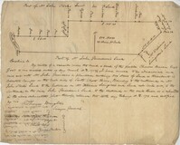
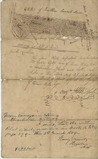
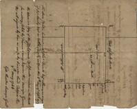
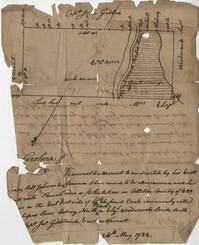
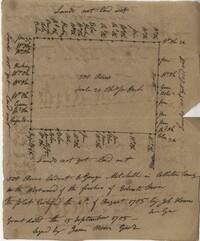
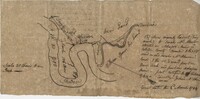
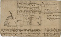
Collection:
John McCrady Plats and Deeds Collection
Institution:
South Carolina Historical Society
Collection:
John McCrady Plats and Deeds Collection
Institution:
South Carolina Historical Society
Collection:
John McCrady Plats and Deeds Collection
Institution:
South Carolina Historical Society
Collection:
John McCrady Plats and Deeds Collection
Institution:
South Carolina Historical Society
Collection:
John McCrady Plats and Deeds Collection
Institution:
South Carolina Historical Society
Collection:
John McCrady Plats and Deeds Collection
Institution:
South Carolina Historical Society
Collection:
John McCrady Plats and Deeds Collection
Institution:
South Carolina Historical Society
Collection:
John McCrady Plats and Deeds Collection
Institution:
South Carolina Historical Society
Collection:
John McCrady Plats and Deeds Collection
Institution:
South Carolina Historical Society
Collection:
John McCrady Plats and Deeds Collection
Institution:
South Carolina Historical Society
Collection:
John McCrady Plats and Deeds Collection
Institution:
South Carolina Historical Society
Collection:
John McCrady Plats and Deeds Collection
Institution:
South Carolina Historical Society
Collection:
John McCrady Plats and Deeds Collection
Institution:
South Carolina Historical Society
Collection:
John McCrady Plats and Deeds Collection
Institution:
South Carolina Historical Society
Collection:
John McCrady Plats and Deeds Collection
Institution:
South Carolina Historical Society
Collection:
John McCrady Plats and Deeds Collection
Institution:
South Carolina Historical Society
Collection:
John McCrady Plats and Deeds Collection
Institution:
South Carolina Historical Society
Collection:
John McCrady Plats and Deeds Collection
Institution:
South Carolina Historical Society
Collection:
John McCrady Plats and Deeds Collection
Institution:
South Carolina Historical Society
Collection:
John McCrady Plats and Deeds Collection
Institution:
South Carolina Historical Society
Collection:
John McCrady Plats and Deeds Collection
Institution:
South Carolina Historical Society
Collection:
John McCrady Plats and Deeds Collection
Institution:
South Carolina Historical Society
Collection:
John McCrady Plats and Deeds Collection
Institution:
South Carolina Historical Society
Collection:
John McCrady Plats and Deeds Collection
Institution:
South Carolina Historical Society
Collection:
John McCrady Plats and Deeds Collection
Institution:
South Carolina Historical Society
Collection:
John McCrady Plats and Deeds Collection
Institution:
South Carolina Historical Society
Collection:
John McCrady Plats and Deeds Collection
Institution:
South Carolina Historical Society