Search
Search Results
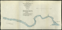
- Creator:
- Howell, G. P. (George Pierce), 1870-1928 and Johnstone, William H., 1867-1936
- Collection:
- U.S. Engineer Maps of the Waccamaw River, 1903
- Institution:
- Coastal Carolina University, Horry County Archives Center
- Creator:
- Geological Survey (U.S.)
- Collection:
- Topographical Maps of South Carolina, 1888 -1975
- Institution:
- University of South Carolina. Government Information and Maps Department
- Creator:
- Schuck-Kolben, R. E.
- Collection:
- Hurricane Hugo Elevation Maps
- Institution:
- University of South Carolina. Government Information and Maps Department
- Creator:
- Schuck-Kolben, R. E.
- Collection:
- Hurricane Hugo Elevation Maps
- Institution:
- University of South Carolina. Government Information and Maps Department
- Creator:
- Schuck-Kolben, R. E.
- Collection:
- Hurricane Hugo Elevation Maps
- Institution:
- University of South Carolina. Government Information and Maps Department
- Creator:
- Schuck-Kolben, R. E.
- Collection:
- Hurricane Hugo Elevation Maps
- Institution:
- University of South Carolina. Government Information and Maps Department
- Creator:
- Schuck-Kolben, R. E.
- Collection:
- Hurricane Hugo Elevation Maps
- Institution:
- University of South Carolina. Government Information and Maps Department
- Creator:
- Schuck-Kolben, R. E.
- Collection:
- Hurricane Hugo Elevation Maps
- Institution:
- University of South Carolina. Government Information and Maps Department
- Creator:
- Schuck-Kolben, R. E.
- Collection:
- Hurricane Hugo Elevation Maps
- Institution:
- University of South Carolina. Government Information and Maps Department
- Collection:
- South Caroliniana Library Map Collection
- Institution:
- University of South Carolina. South Caroliniana Library